Upscaling effects on infectious disease emergence risk emphasize the need for local planning in primary prevention within biodiversity hotspots https://doi.org/10.1038/s41598-025-21514-4
In our latest article in Scientific report, Dr Renata Muylaert and colleagues explore how host habitat, biodiversity, human encroachment, and population-at-risk interact to shape infectious disease emergence risk across multiple spatial scales.
📍 Focusing on Java, Indonesia—a hotspot of human–wildlife interface—the study reveals that upscaling data leads to critical information loss.
✅ The sweet spot? Spatial resolutions no coarser than 500 m when native-resolution processing isn’t feasible.
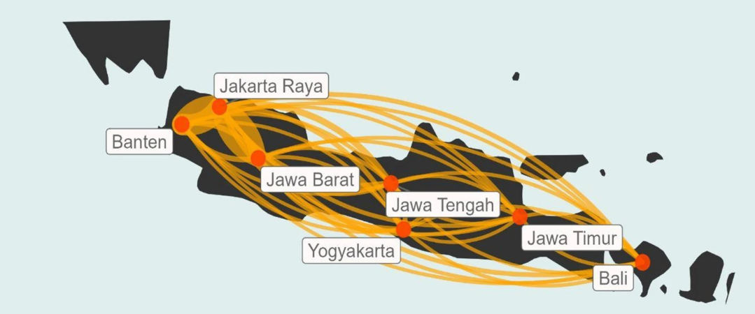
🧭 Gravity models identify Jakarta and West Java as high-risk areas for epidemic spread, with surrounding regions contributing in scale-sensitive ways shaped by forest management and agroforestry practices.
🔍 The key takeaway: Zoonotic risk assessment must stay grounded in local contexts where biodiversity loss and human pressures converge—strengthening the case for landscape-scale planning in pandemic prevention and preparedness.